We are in pain. Great pain. Our muscles protest any movement more strenuous than thumbing our iPhones. The crew of Delancey has not been involved in a mishap. We were not caught in a storm. I have not chopped off another finger.
We have exercised.
It all started about a week ago when we arrived in Georgetown, Great Exuma, in the Bahamas. When we last touched base, we were waiting for good weather to depart our marina in South Bimini to head east across the Grand Bahama Bank towards the Exuma island chain. On that fortuitous day we left the dock at dawn, along with all the boats in the marina. We rounded the top of North Bimini as the sun rose and turned east for a long day’s motor across the bank directly into the wind.

Bye bye Bimini.
The Bahama bank is like a table in the middle of a swimming pool, its surface covered by an inch or so of water (in this tortured illustration, the islands and cays are utensils and salt shakers sitting on the table, just poking above the surface). After an ocean passage with 3,000 feet of water below your keel, you quite abruptly find yourself in 12-foot-deep water extending for 40 miles in all directions. As we gingerly made our way across the bank, we kept in touch via VHF (though not by sight) with fellow cruisers Jim and Rhonda aboard S/V Windarra and Jeff and Bonnie aboard S/V Light Waves. As the day came to a close, they pressed on to Nassau while we elected to anchor on the bank overnight.
This was one of the weirder anchoring experiences we’ve ever had. When anchoring, you generally look for shallow water in a cove or bay or at least protected from the wind in the lee of an island. On the bank, there is shallow water everywhere but absolutely zero protection. You just get a mile or so out of the shipping routes (so you don’t get hit by an island freighter in the middle of the night) and drop anchor anywhere. It felt like pulling over to the side of the road for the night. Normally, when we approach an anchorage, Deb and I have detailed discussions about where best to drop the hook. This time we were like, “How ‘bout here?” “Sure, whatever.”
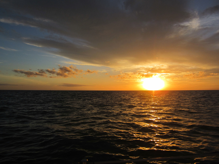
First light found us again motoring into the sun and wind past the Northwest Channel marker (a stick in the water) and back into deep water toward the island of New Providence.
That stick on the right is the last navigation aid we'd ever see.
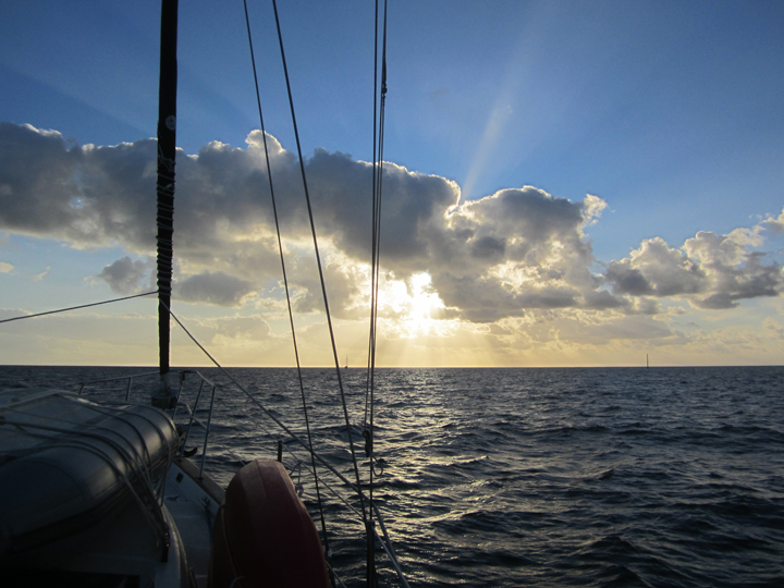
We elected to avoid the glitz and expense of Nassau, instead anchoring in a bay at the western end of the island. After waiting out another front that dumped so much rain that we were able to fill our water tank, we climbed back onto the banks to reach Highborne Cay (pronounced “key”) in the northern Exumas. The next morning we continued from Highborne to Shroud Cay. The trip down the Exuma chain points the boat in a south or south-southeasterly direction, perfect for sailing in the prevailing easterly winds. With 20 knots of wind just ahead of the beam and both sails reefed, we enjoyed our first actual sailing (not motorsailing, but sailing sailing) since rounding the New Jersey coast back in October.
Off-watch crew Lucy conserved her energy should she be called on to assist in an emergency.

Once anchored off Shroud Cay, we hoisted the dink off the deck and climbed in to explore. Shroud Cay is veined with saltwater creeks edged with vast mangrove beds. After finding the mouth of one creek, we puttered along its meandering route to the eastern side of the island where we beached the dinghy, took a dip in Exuma Sound, and climbed the modest peak.

The next day we again sailed (sailed!), this time to Big Majors Spot, a west-facing bay north of Staniel Cay. Chris Parker’s evening forecast called for yet another front to come through in the next couple of days bringing squalls and wind clocking to the west, so the next morning we relocated to one of the few west-protected anchorages in the area. While getting underway on that calm morning, we were taken by the clarity of the water that allowed us to see for the first time our anchor neatly buried in sand, 15 feet below the surface.

We motored around the corner to an anchorage between Big Majors Spot and Little Majors Spot, accurately described as “Between the Majors”. We tucked in a couple days before the arrival of the front to ensure we’d get a good parking space before the anchorage inevitably crowded up. Sure enough, we were only the second boat in the anchorage. By the time the weather blew through two days later, there were more than 20 boats in sight.
Arriving early gave us time to attend to some life-maintenance, as well as explore and play. We visited the Staniel Cay Yacht Club to fill our water jerry cans ($0.30/gallon) and deposit trash ($6.00/bag), as well as enjoy lunch and conversations with other humans at their bar. We stopped at the local BTC (Bahamas Telephone Company) office to top-up our phones. Deb pulled out the bucket and plunger to run a load of laundry.

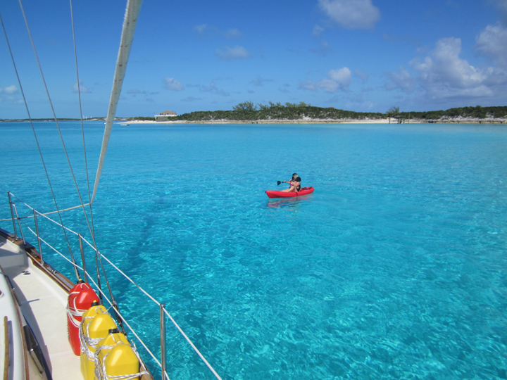
Deb poked around the anchorage in our new kayak.
We zoomed around in the dink to snorkel Thunderball Cove, a natural cave skylit by occuli so named because it featured in the James Bond film of the same name. (Sorry no pics. Gotta get a waterproof camera someday.)

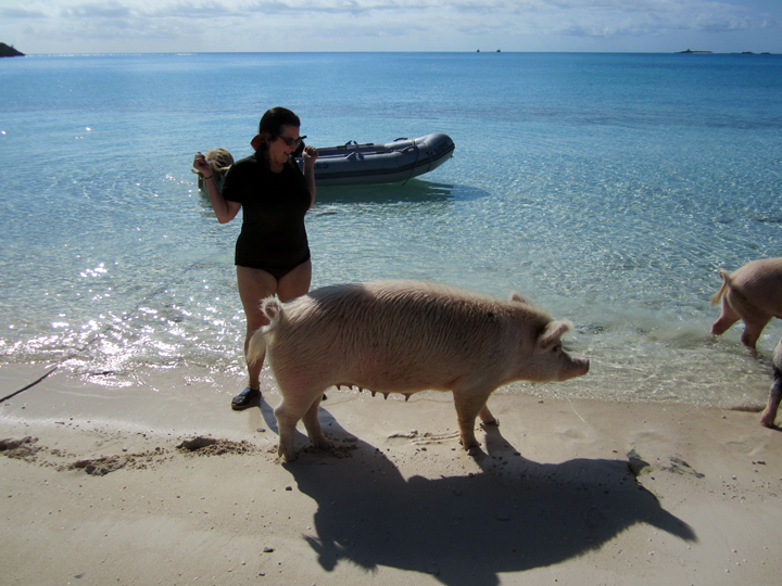
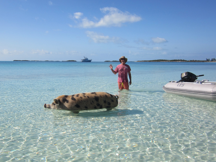
We visited Pig Beach, so named because it is populated by wild pigs who, expecting handouts, immediately surround any visitors who approach the beach.
Eventually, the bad weather arrived and we hunkered down in the big boat. I’ve written enough about the anxieties of riding out a blow. After it was over we were told that a 90-foot motor yacht anchored on the west side of Big Majors Spot dragged into the rocks around 3am. Suffice to say, we were happy that we relocated and gave our anchor two days to dig in before the front hit.

Here it comes.
Once we knew we weren’t going anywhere involuntarily, we got domestic and made a couple batches of pasta, eating fresh pappardelle with butternut squash and spinach that evening and hanging linguini in the cockpit to dry overnight.

Following the blow, Chris Parker predicted a good weather window for making our way south to Georgetown, so we fueled and watered and staged ourselves for an early-morning departure. We again sailed, this time with wind slightly abaft the beam (i.e.: from a little bit behind us, my favorite point of sail) to a one-boat sized bay off the uninhabited, diminutive, and inaccurately-named Big Galliot Cay.
The Exuma island chain marks the boundary between the shallow Exuma Bank to the southwest and the deep Exuma Sound to the northeast. The spaces between the cays and islands offer places to transit between these two bodies of water. Because of the differences in depth, the prevailing winds, and the daily tides, the conditions in these “cuts” can be quite rough, especially when wind is against current, creating standing waves known as “rages”.
So far, we’ve spent all our time on the bank side of the Exumas. Travelling to Georgetown requires that we take one of these cuts to cross to the sound side. Anchoring for the evening off Big Galliot Cay would allow us to exit the bank through the relatively deep and wide Galliot Cut at slack water (dead low tide), around 6:30am.
In the end, the cut was a non-event. We got a bit of pushback from the current entering the bank, but nothing to raise an eyebrow for anybody who regularly transits New York City’s Hell Gate. By 7:30, we turned southeast motorsailing in light northeast winds under jib.

Of course, we weren’t alone. Everybody received the same forecast as us and all along the Exuma chain, boats were popping out of cuts. By 9am we were one of about 24 sailboats making our way to Georgetown. The wind gradually picked up until we were able to shut off the iron genny and continue under full sail.
Now in deep water again, we tried trolling for fish. VHF chatter reported other boats catching mahi mahi. We kept up our record of fishing success by losing three lures, two of which were bitten off through the metal-braid leader. Good thing we made that pasta.
Along with the wind built a following sea that made getting sails down and entering tricky Elizabeth Harbor, with its maze of submerged coral heads, more stressful than either of us were prepared for. By 4pm we were anchored among what looked like every sailboat in the western hemisphere, with frayed nerves and exhausted bodies, seriously questioning our commitment to proceeding any further south.
Happily, this wasn’t a question we had to address any time soon. We’d arrived in Georgetown, variously described as the “Cruiser’s Mecca” and the “Pot of Gold at the End of the Rainbow”, as well as “Chicken Harbor” for all the folks with plans to venture to the Caribbean but never manage to make it any further south.
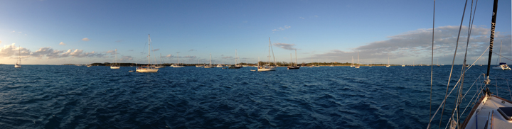
Elizabeth Harbor is bound to the southwest by Great Exuma Island, on which Georgetown proper is located, and to the northeast by Stocking Island, a barrier island. The nine-mile-long, one-mile-wide harbor is open at each end. For the past week, Delancey has been anchored off the center of Stocking Island, a short, wet, dinghy ride to the beach and a long, wet, dinghy ride into town.
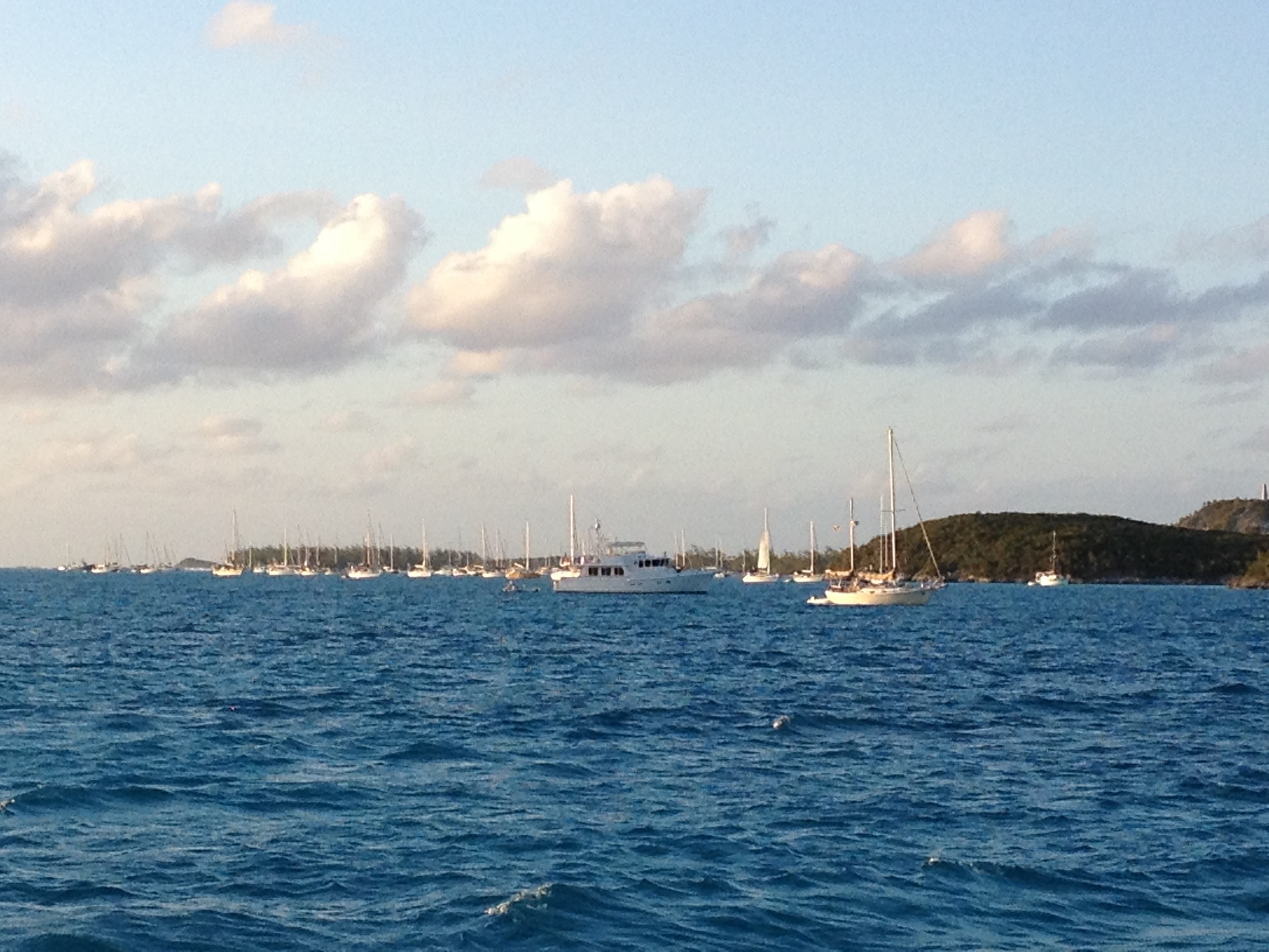

It’s difficult to capture the enormity of this place in pictures. Somebody made a count and reported that this week there were 312 boats across the dozen-or-so anchorages in the harbor. The community is very organized, with daily events including volleyball (both fun and regulation games), poker matches, beach yoga, water aerobics, and women’s bible study. It’s sort of a combination Senior Living Center and Perpetual Spring Break.
All events, as well as that boat-count report, were announced during the daily 8am VHF cruisers net (channel 72), a moderated party-line in which anybody can make local business, community, and for-sale-or-trade announcements. New arrivals report in and are treated to a brief orientation guide. Everybody monitors channel 68 all day, which acts as the cruiser’s hailing channel. Once the hailed boat responds, the parties agree on a working channel to switch to and conduct their business. Of course, anybody listening (i.e.: everybody) can switch to that channel and listen in as well. I can pick up the radio and ask a general question like, “How much is a taxi to the airport?” and get five responses immediately, with advice on travel times and tipping.
At the first opportunity, we buzzed into town. The local economy is dependent on this floating village, and thus very cruiser-friendly, with convenient trash deposit ($3/bag), laundry services, markets, and restaurants. There’s even free water at the (crowded) dinghy dock.
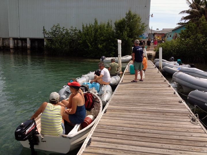
In the queue for free water.
Downtown Georgetown rings Lake Victoria (“The Pond”) and is entered under a narrow and low bridge overpass that can be a little rough when the current is running (but you already got soaked crossing the harbor, so no matter).

We joined the local library ($3/year), donated all the books we’d read on board, and replaced them with a stack of borrowed books.

Georgetown Public Library
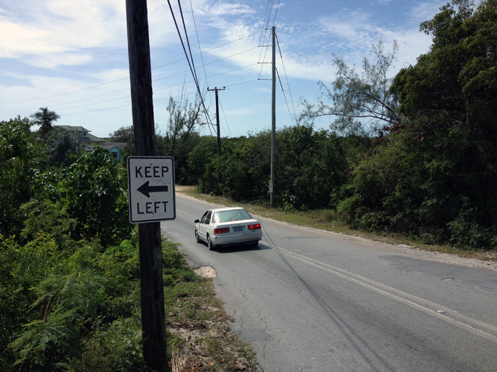
We explored while trying to not get hit by cars.
Hurricane damage.

We joined a bunch of French Canadian cruisers in the shuttle (i.e.: the back of a pickup truck) to the meat market about four miles out of town.

We enjoyed a burger-and-a-beer ($10) at the Redboone Café. (We’ve actually enjoyed this a few times now.)
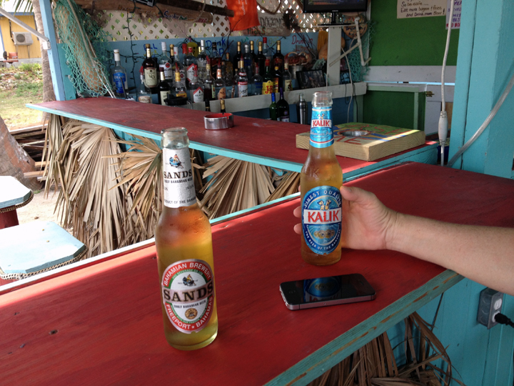
Burgers, beers, and wifi.
On the other side of the harbor, we’ve played on the beaches of Stocking Island. We’re anchored off what is known as Volleyball Beach or Chat N’ Chill Beach, for the beach courts and small bar located there.

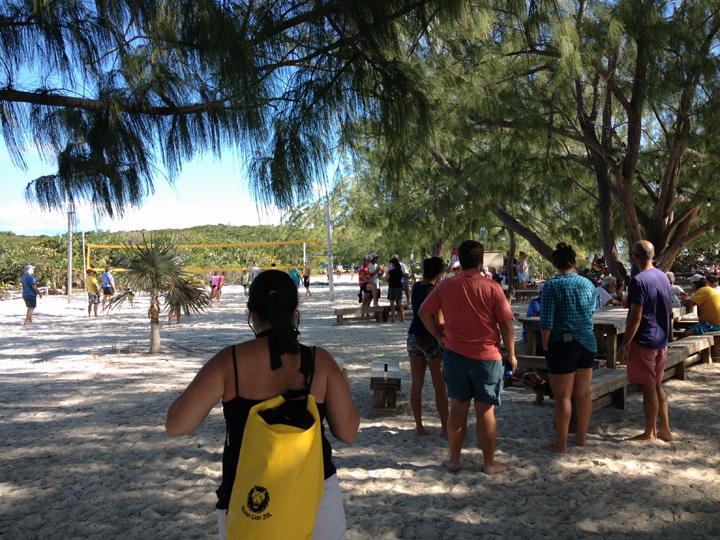
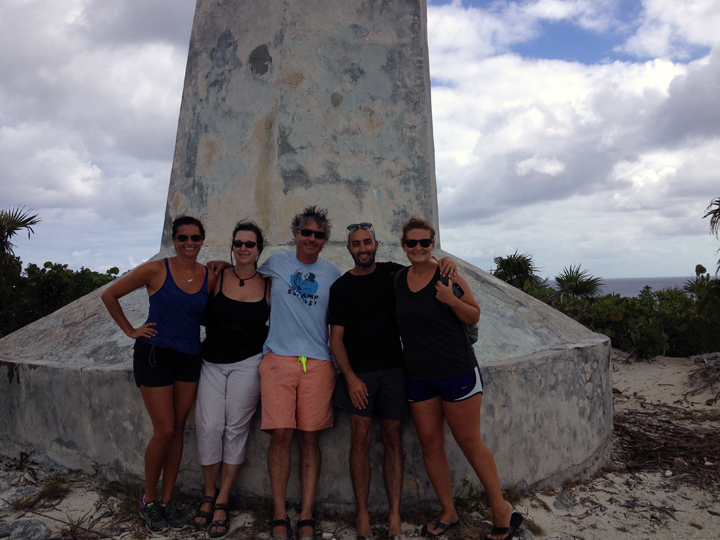
When we first checked in during the morning cruiser’s net, we heard another new arrival checking in also from New York City. After the net, we contacted each other on channel 68 and had a chat, agreeing that we should get together. Later on that first day, while I was drooling over fresh vegetables in Exuma Market, a handsome young man looked me in the eye and said, “You look like you’re from New York.” This is how we met Brian and Lauren of S/V Nightingale Tune, the other new arrivals from NYC. Brian and Lauren introduced us to Allison and Bo of S/V Selah, and the six of us spent much of the week together, hiking to the monument (helpfully known as “Monument”) on Stocking Island, hosting happy hours that bleed into dinners aboard each other’s boats, and meeting on Volleyball Beach for morning workouts led by the irrepressible and enthusiastic taskmaster Allison.


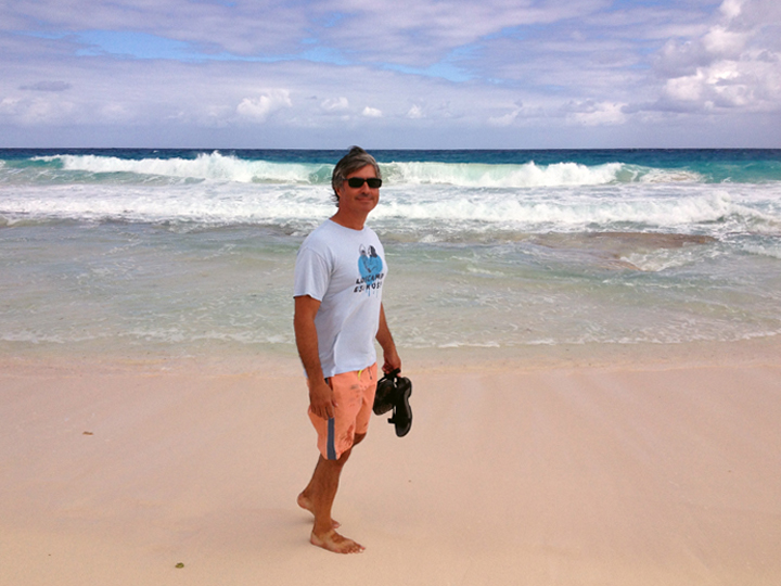
As always, my hair is perfect.
Which explains why we are in such pain today. Still, it’s a good pain, and we’ll shortly miss it. Lauren and Brian left this morning to meet visitors a couple islands up the chain. Soon, Allison and Bo are leaving their boat here and flying back home to tend to some business. They’ll both be back, but everybody plans on heading south, so if we miss each other here, we’ll likely cross paths again in a different country.
And there’s new stuff to look forward to. Next week is the annual Cruiser’s Regatta, a week of boat races, live music, parties, and events (boat-decorating contests, pet parades, variety shows) to fill an already-busy social calendar. More importantly, we’ve got visitors! Our super pals Yvonne and Onat are flying in on Friday for a week aboard! Eve and Onat are longtime sailing buddies of ours, so we all know how to coexist in small spaces and how to operate a marine toilet. Onat is a life-long fisherman and we’re looking for him to show us how it’s done. The current forecast calls for mild weather with no big fronts predicted. We’re terribly excited and looking forward to reporting on the fun. In the meantime, I’ve got to clean up the V-berth.

Take care, everyone!